

Dr. Eng. Abdul Rachman Rasyid, ST., M.Si
| Nip | 197410062008121002 |
|---|---|
| Jabatan | Lektor |
| Bidang Keahlian | Penataan Wilayah Kota dan Spasial |
| Surat Elektronik | rachmanrasyid[at]eng[dot]unhas.ac.id |
Penelitian
Pengabdian Masyarakat
Publikasi
- Identifikasi Pola Pemanfaatan Ruang Di Wilayah Pesisir Kabupaten Takalar (2010)
- Arahan Pemanfaatan Ruang Wilayah Pesisir dan Laut Kab. Takalar (2011)
- Mitigasi Bencana Gerakan Tanah Di Kabupaten Enrekang (Mitigation of Vulnerable to Areas Landslide The Regency of Enrekang South Sulawesi Province (2012)
- Use of Frequency Ratio Approach in Landslide Susceptibility Mapping in Jeneberang Watershed of South Sulawesi, Indonesia (2014)
- GIS Based Analysis for Landslide Susceptibility Mapping Using Logistic Regression Model at Lompobattang Mountain, Indonesia (2015)
- Landslide susceptibility mapping using DinSAR and statistic model in Bawakaraeng mountain, Sulawesi, Indonesia (co-authors) (2015)
- Tropical Landslide Susceptibility Mapping using Differential Interferometry SAR and Statistic Model in Bawakaraeng and Lompobattang Mountain, Indonesia (co-authors) (2015)
- Landslide Susceptibility Mapping Using Logistic Regression in Eastern Side of Lompobattang Mountain, Indonesia (2016)
- Weight of Evidence model applied to landslide susceptibility mapping based on GIS in Bawakaraeng Lompobattang Mountain (2016)
- Temporal validation of landslide susceptibility map: a case of Bawakaraeng Lompobattang Mountain in Indonesia (2016)
- Performance of frequency ratio and logistic regression model in creating GIS based landslides susceptibility map at Lompobattang Mountain, Indonesia (2016)
- GIS based landslide susceptibility mapping using artificial neural network (ANN) Model in South Sulawesi Province, Indonesia (2018)
- Implementing landslide susceptibility map at watershed scale of Lompobattang Mountain South Sulawesi, Indonesia (2018)
- The Vulnerable Socioeconomic Conflict on the Gate Community Neighborhood in Makassar (2019)
- Development Direction of Gunung Nona Tourism Area Based on Landslide Mitigation (2019)
- Penyuluhan dan Pendampingan Pemetaan Partisipatif di Kecamatan Anggeraja Kabupaten Enrekang (2019)
- Peningkatan Kualitas Infrastruktur Permukiman Melalui Pemberdayaan Masyarakat Desa/Kelurahan Berbasis Database Digital Keruangan (Spasial) di Kabupaten Wajo (2019)
- The existence of a mangrove ecosystem as nature tourism-based on global warming mitigation in Lakkang island (2019)
- Analysis of Changes in Urban Heat Islands in Gorontalo City Using the Landsat TM8 Imagery (2021)
Berita terkini
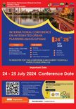 International Conference of Integrated UrbanPlanning (ICIUP) 2024
 2024-07-11T07:13:21.000Z
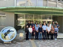 Delegasi Departemen Perencanaan Wilayah dan Kota (PWK) Universitas Hasanuddin mengikuti Sakura Science Exchange Program 2023
 2023-08-31T03:57:44.000Z
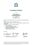 Departemen PWK mendapatkan Sertifikat Internasional ASIIN
 2023-04-11T18:58:41.000Z
 Program Studi Magister PWK Perdana Berhasil Mengeluarkan Lulusan Magister
 2022-08-25T16:31:44.000Z
 Mahasiswa PWK mengikuti Kursus Program Pembangunan Perkotaan Berkelanjutan yang diselenggarakan oleh Yokohama City University
 2022-08-11T17:38:47.000Z
- more_horiz